


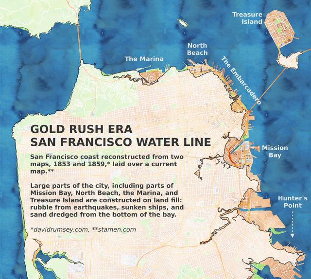
Rosie Cima, Priceonomics; Map sources: Stamen, David Rumsey Collection
The city of San Francisco is geographically constrained to the tip of a peninsula, measuring appproximately seven miles wide by seven miles long. These physical boundaries are often implicated in conversation about the city’s current housing crisis, especially by proponents of vertical expansion. But for a lot of San Francisco’s history, when San Franciscans wanted more real estate they favored horizontal expansion: they simply made more land.
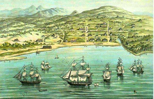
The tiny town of Yerba Buena, which would later become San Francisco, ended up expanding in every direction possible
The Embarcadero started to fill in as early as the 1840s and 50s, as wharfs and piers were built farther and farther into the water, their bases creeped forward, and ships were abandoned. One ship — the Niantic, was famously beached near what is now the corner of Clay and Montgomery, after most of her crew deserted to go gold mining. Someone adopted the ship, cut a door in it’s hull, ran a plank from the shore, and converted it into a hotel, warehouse, and store. It’s been buried, forgotten, excavated, restored, and buried again several times in the intervening century-and-a-half — the last time being during the construction of the Transamerica building.
Mission Bay was a gulf of water surrounded by uninhabitable marsh, which many used as a dump, some in hopes of drying it out into viable real estate. It hit its tipping point after the catastrophic earthquake of 1906. The quake and subsequent fire had left the city’s infrastructure in ruin, and much of the wreckage went into the bay and surrounding marshland, until there was little enough bay and marshland that the region was suitable for development.
The federal government built most of Treasure Island in the 1930s out of quarried rock, sand dredged from the bottom of the bay, and topsoil.
There are some major trade-offs to making your own land. For one, you can’t go very far in the San Francisco Bay Area without being reminded that its wetlands and many of their flora and fauna are endangered. For another, as even the earliest builders discovered, landfill fares much worse in an earthquake than bedrock. This means that while San Francisco is by no means the only city in the world to build on land fill (also called infill and reclaimed land), its proximity to several major fault lines makes it one of the more precarious.

USGS liquefaction susceptibility map of San Francisco — red indicates regions that exhibit “very high susceptibility” and corresponds to areas of land fill. Yellow regions to the west, which exhibit “moderate” susceptibility, are built on levelled sand dunes, (legend)
Present day seismic hazard maps illuminate the fact that that not all land was created equal: some was formed out of centuries of slow tectonic creep, and some of the neighborhoods of San Francisco were packed together out of sand and trash by generations of human hands.
In 2006 — 100 years after the great quake of 1906 — a USGS representative stated that if an earthquake of the same magnitude hit the city that day, it would destroy nearly 40% of the city’s buildings. The geologist also noted, “All the areas built on fill, such as the Bayfront, Marina district, financial district, and SoMa [south of Market], will be very vulnerable.”
After the original Marina land fill was decimated by the 1906 earthquake, the city filled the area again as the site of the 1915 world’s fair, and it suffered again in the Loma Prieta quake in 1989.
Land fill tends to undergo liquefaction in earthquakes. If you take a bucket of water-saturated sand and press down on it with the flat of your palm it will act like a relatively stable solid. But if you shake the bucket hard enough and long enough, the sand becomes loose and pourable — like a liquid. In an earthquake, what seems like a solid foundation can turn into quicksand in a matter of seconds. This can damage gas and water mains and electrical lines, dramatically sink or tilt buildings, or cause them to collapse.
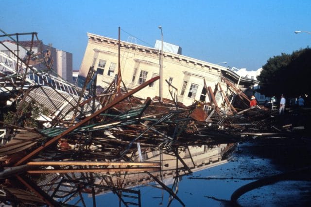
A house in the Marina District after the Loma Prieta earthquake of 1989
In the past few decades, there have been several municipal efforts to make buildings more earthquake-safe, particularly in zones highly susceptible to liquefaction. But while it’s certainly a good idea to reinforce a building’s frame, it’s still probably going to suffer some damage when the land fill foundation liquefies, and the asphalt starts “rippling like waves in the bay.”
This post was written by Rosie Cima; you can follow her on Twitter here. To get occasional notifications when we write blog posts, please sign up for our email list